The GPS Dynomometer
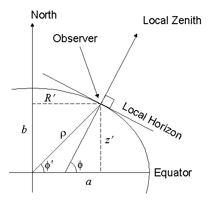
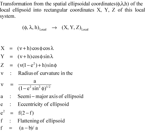
The earth surface can be approximated as an Oblate Sphereoid or Oblate Ellipsoid. The GPS system uses a definition contained in WGS-84. This model has an equitorial radius of 20925646 feet and a polar radius of 20855487 feet.
F = (x/a)^2 + (y/b)^2 + (z/c)^2 where a = b = 20925646 and c = 20855487.
GPS delivers to us 4 peices of data. Longitude, Latitude, Altitude, and Time.
GPS altitude (or Geodetic Height????????) is the distance from this surface. Barometric Altitude is different from the GPS Altitude. It is based on air pressure.


http://www.spenvis.oma.be/spenvis/help/background/coortran/coortran.html
http://www.celestrak.com/columns/v02n03/
http://soaring.aerobatics.ws/SOARING/BGA/wg84figs.html
http://mtp.jpl.nasa.gov/notes/altitude/altitude.html
http://www.scottkurowski.com/flying.htm
http://www.avionicswest.com/PDFiles/alt2.pdf
http://www.wgs84.com/files/wgsman24.pdf
http://www.ngs.noaa.gov/
This site has not been
updated since Fall 2006.
Since then, all new projects
have been place on my wiki
site.
If you like what you see on
this site, Make sure to go
to the wiki for even better
projects.